Topographic Surveys
Topographic surveys are essential for a variety of purposes, primarily used to delineate the surface of the ground with contours and spot elevations, as well as to document existing site improvements. Often, a topographic map is the first map acquired to determine existing site conditions, making it a key element utilized by design professionals.
Architects, engineers, geologists, and building contractors frequently request topographic maps as foundational tools for designing proposed improvements. These maps provide critical data that inform the planning and development processes.
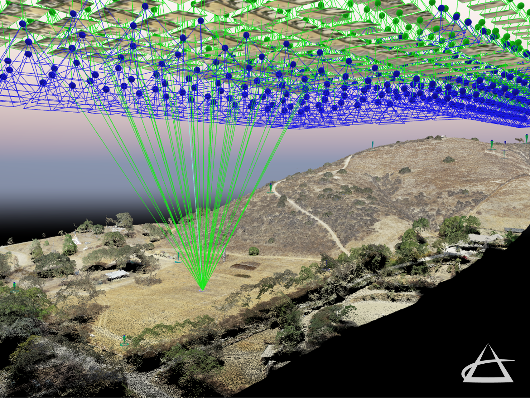
A topographic survey gathers precise data about the elevation of points on a piece of land and presents them as contour lines on a plot. These contour lines are used to delineate surface elevations, land contours, drainage patterns, and other key features. The purpose of a topographic survey is to collect comprehensive data on both the natural and man-made features of the land, as well as its elevations. This type of map may also illustrate site improvements such as buildings, structures, walls, fences, trees, and streets.