Drone Aerial Mapping
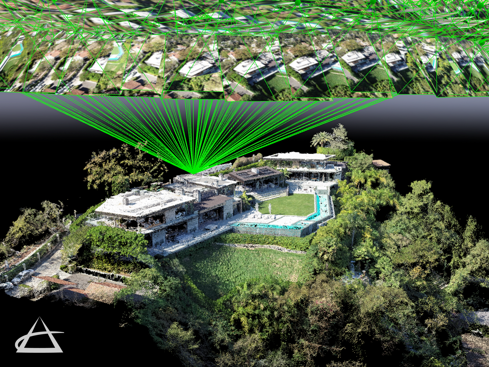
EPOCH leads in the field of geospatial and survey & mapping technologies by utilizing Unmanned Aerial System (UAS) drones for surveying, mapping, remote sensing, and data collection. Equipped with specialized cameras and high-precision GPS, our drones efficiently survey project areas and collect diverse data types for thorough analysis. This data is transformed into precise 3D models, point clouds, and 2D maps, serving as a robust foundation for project planning and research.
Our aerial mapping capabilities include clash detection, as-built mapping, vegetation and plant health monitoring, construction progress tracking, stockpile measurement, and site feature identification. Our drones also create high-resolution ortho-mosaic photography, delivering accurate, full-color images of project areas and their surroundings. These images are crucial for monitoring, reporting, research, planning, engineering, and design.
EPOCH’s team includes seven FAA Part 107 certified UAS drone pilots, a mapping scientist, and several Professional Land Surveyors, ensuring we stay at the cutting edge of this technology.